14km Course Description (14km, 28km, 42km and 56km races) – UPDATED FOR 2024
Depending on your race distance, the 14km, 28km, 42km and 56km races are made up of loops of this 14 km track.
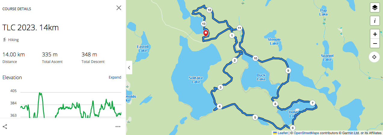
This course features some of the most beautiful scenery you will ever see. These historic trails will take you alongside five lakes, several ponds and wetlands, across creeks and boardwalks and under some amazing rock formations. It is 95% trails and 5% gravel road. Considered to be a challenging course, it is generally flat to rolling. It has some longer gradual inclines such as up the Wetlands and some shorter steep hills that will get the heart rate up. With bush cover and the lakeside for most of the course, the summertime heat will be tempered. The one area where we have seen mosquitoes is downhill, so you can outrun them!
Download the 14km course as a .gpx for your GPS device by using the link provided: 14km Course Download
7km Course Description – TLC 2024
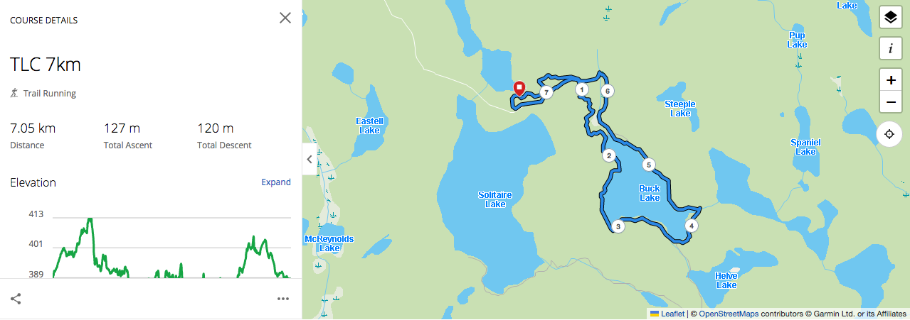 7km loop has 127m of elevation gain (and loss, being a loop)
Download the 7km course as a .gpx for your GPS device by using the link provided: 7km Course Download